Sasso Piatto (Plattkofel)
A mountain in Sassolungo and Alpe di Siusi, 2,964m. Sassopiatto / Plattkofel / Sas Plat
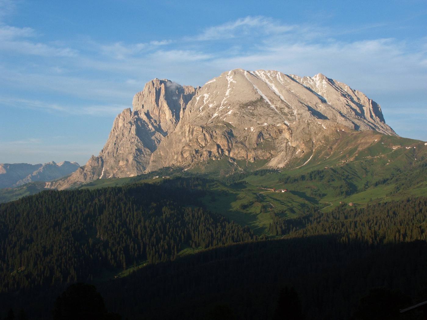

- Elevation
- 2,964m Wikidata (second-hand, as of 2026-11-01) OpenStreetMap gives 2,958m
- Group
- Sassolungo and Alpe di Siusi
- Summit position
- 46.5141, 11.7158OpenStreetMap
- Huts nearby
- 11 hutswithin 6 km of the summit, straight line
Huts nearby (closest to the summit first, straight line)
- Rifugio Vicenza / Langkofelhütte about 0.9 km 2,253m / 2026 season Not confirmed
- Rifugio Sandro Pertini about 1.5 km 2,300m / Usually early June to late September
- Plattkofelhütte / Rifugio Sasso Piatto about 1.6 km 2,300m / 2026 season Not confirmed
- Rifugio Toni Demetz about 1.8 km 2,685m / Usually mid-June to early October
- Rifugio Friedrich August about 2.7 km 2,300m / 2026 season Not confirmed
- Rifugio Micheluzzi about 2.7 km 1,860m / Usually early June to mid-October
- Rifugio Salei / Salei Hütte about 3.0 km 2,225m / 2026 season Not confirmed
- Rifugio Carlo Valentini about 3.3 km 2,218m / 2026 season Not confirmed
- Rifugio Des Alpes about 3.4 km 2,387m / 2026 season Not confirmed
- Rifugio Dona about 3.8 km 2,100m / Usually ? to late September
- Rifugio Antermoia about 5.7 km 2,497m / 2026 season Not confirmed
Distances are straight lines on the map, not walking distances. To line up huts and see who to contact, use the Itinerary board
Questions
- How high is Sasso Piatto (Plattkofel)?
- 2,964m (Wikidata, second-hand, as of 2026-11-01).
- Where in the Dolomites is Sasso Piatto (Plattkofel)?
- It is in Sassolungo and Alpe di Siusi.
- Which huts can I stay at when climbing Sasso Piatto (Plattkofel)?
- 11 huts within 6 km in a straight line. Nearest first: Rifugio Vicenza / Langkofelhütte (about 0.9 km), Rifugio Sandro Pertini (about 1.5 km), Plattkofelhütte / Rifugio Sasso Piatto (about 1.6 km), Rifugio Toni Demetz (about 1.8 km), Rifugio Friedrich August (about 2.7 km).
Answers are built from the facts on this page (each with its source and check date). Check the official site before you go.
Elevation and name spellings are from Wikidata (second-hand); the summit position is from OpenStreetMap. Routes and walking times will be added once checked against official sources.