Destinations and areas › Japan
Mount Fuji
Japan · 1 routes · 14 huts
Routes
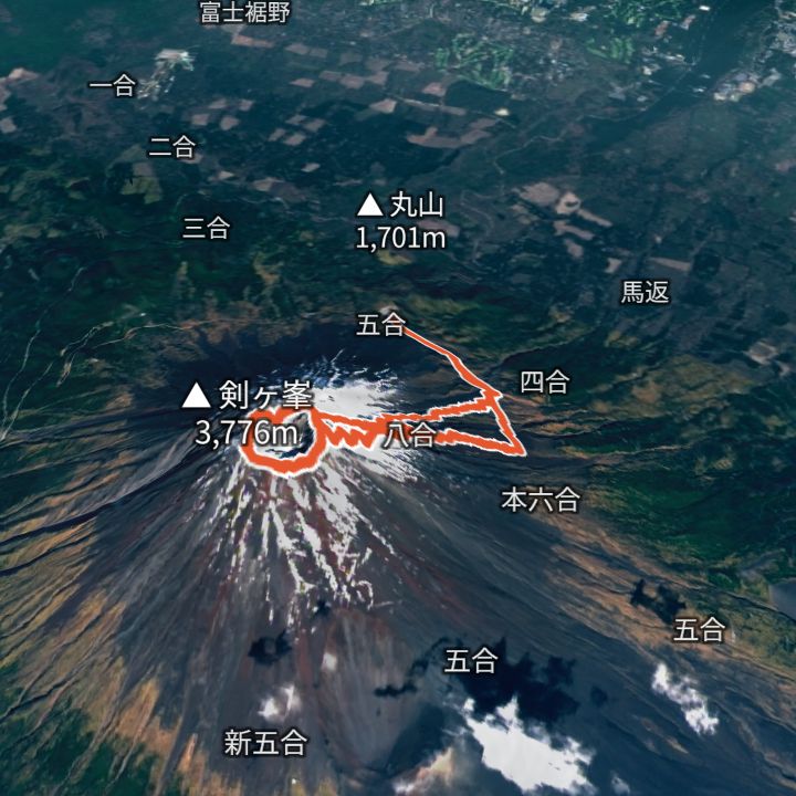 Map: GSI Japan, EOxCloudless 2025 (Copernicus Sentinel)
Mount Fuji (Kengamine) 3,776m
Mount Fuji by the Yoshida trail
From the Fuji Subaru Line 5th Station up the Yoshida trail to a hut around the 8th station, then on to the summit, round the crater rim past Kengamine (3,776 m), and back down the descent trail.
Mountain huts
- Fujisan Hotel (Hon-8th station) (本八合目 富士山ホテル) 3,400m / Not confirmed
- Tomoekan (Hon-8th station) (本八合目トモエ館) 3,400m / Not confirmed
- Horaikan (蓬莱館) 3,150m / Not confirmed
- Taishikan (太子舘) 3,100m / 30 Jun – 9 Sep
- Toyokan (東洋館) 3,000m / 30 Jun – 10 Sep
- Toriiso (鳥居荘) 2,900m / Not confirmed
- Kamaiwakan (鎌岩館) 2,790m / Not confirmed
- Tomoekan (7th station) (七合目トモエ館) 2,740m / Not confirmed
- Hinodekan (日の出館) 2,720m / Not confirmed
- Gansomuro (元祖室) Elevation not confirmed / Not confirmed
- Fuji Ichikan (富士一館) Elevation not confirmed / Not confirmed
- Hakuunso (白雲荘) Elevation not confirmed / 1 Jul – 10 Sep
- Hanagoya (花小屋) Elevation not confirmed / Not confirmed
- Satomidaira Seikanso (里見平★星観荘) Elevation not confirmed / Not confirmed
Mountains
- Mount Fuji (富士山) 3,776m
Local basics
- Emergency number
- 110 (police) / 119 (fire and ambulance)
- Currency
- JPY
- Time zone
- Asia/Tokyo
- Difficulty scale
- Prefectural mountain grading (stamina 1–10, technical A–E)
- Route lines
- Paths in GSI (Japan) map data