3 nights / 4 days / approx. 45.3 km / High point 3,180m
Daikiretto loop from Kamikochi (Kita-Hotaka to Yari)
Kamikochi → Yarigatake → Kamikochi
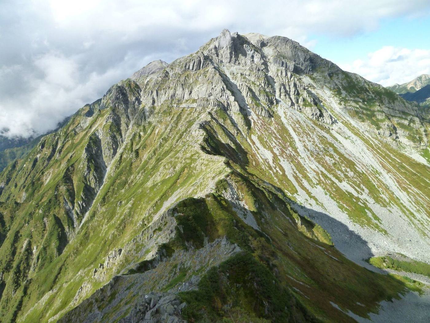
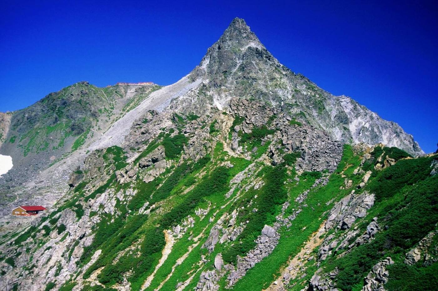
From Kamikochi via Karasawa to Kita-Hotaka, over the Daikiretto notch to Minamidake and Yari, then down the Yarisawa valley to Kamikochi. The most exposed ridge in the range.
How hard is it?
Strenuous.
Sustained rock
Stamina 9 / 10Walking 25h12
“2–3 nights or more is advisable”
Technical E
Continuous fall risk; advanced judgement needed
- Typical
- 3 nights / 4 days
- Walking time
- 25h12walking only, no breaks
- Distance
- approx. 45.3 km
- Total climb
- approx. 2,650m high point Yarigatake 3,180m
Stamina and technical grades: Nagano Prefecture mountain grading, No.26 (our translation). HutsGo is still checking these against the table. See the table
How do I get there?
Reachable by Bus.
Back to the same trailhead. Private cars restricted
- Sawando or Hirayu 沢渡・平湯
- Bus
- Kamikochi 1,500m / Restricted (park and change)
- 3 nights / 4 days, out and back
- Kamikochi Back to the same trailhead
Last ride down 17:55 Matsumoto / Shinshimashima to Kamikochi (松本・新島々〜上高地)
Times, fares and parking →When are the huts open?
Open today (11/01): 6 of 7 huts
- Tokusawaen 25 Apr – 3 Nov
- Yokoo Sanso 27 Apr – 3 Nov
- Karasawa Hutte 27 Apr – 3 Nov
- Karasawa-goya 27 Apr – 3 Nov
- Kitahotaka-goya 28 Apr – 3 Nov
- Minamidake-goya 11 Jul – 11 Oct
- Yarigatake Sanso 27 Apr – 3 Nov
2026 season dates, from each hut's official site and Nagano Prefecture's hut list (sources on each hut page).
When does booking open?
7 huts to stay at. Book with each hut (HutsGo takes no bookings).
- Tokusawaen Taking bookings for the whole season no… / unofficial
- Yokoo Sanso One month before your stay, 07:00 JST, …
- Karasawa Hutte One month before your stay (same date),…
- Karasawa-goya One month before your stay (same date).…
- Kitahotaka-goya One month before your stay (same date, …
- Minamidake-goya One month before your stay, 09:00 JST
1 more in the list below
Pick your huts and plan the daysMap and elevation
Times split the official prefectural total (no breaks)
The line follows the GSI map footpaths. Trust the signposts on the day. Save GPX
High point 3,180m / Total ascent approx. 1,680m / 1,680m of climbing from Kamikochi (1,500m)
Hut (tap for details) Trailhead Point passed Elevation not confirmed
The horizontal axis is the order of the route, not time: we have not confirmed this route's leg times against an official source. The ridge line simply joins the recorded points, so it does not show the real shape of the terrain. Total ascent is an approximation summed between those points. Karasawa Hutte, Minamidake-goya, Yarigatake Sanso, Yarisawa Lodge have no confirmed elevation, so they are placed provisionally between the points either side.


Stop by stop
Section times split the prefecture's official total course time across sections by path length, climb and descent.
-
1,500m
Kamikochi (上高地)Trailhead
Closed to private cars all year. Bus or taxi from Sawando or Hirayu.
- approx. 2h15 up 101m down 86m
-
1,560mtopo map
Tokusawaen (徳澤園)Lodge
25 Apr – 3 Nov Secondary source (as of 2026-09-13)
Dinner + breakfast ¥17,600+ No meals ¥11,000 Tent ¥2,000
- QR payment
- Bath
Booking opensTaking bookings for the whole season now, by phone only
- approx. 1h15 up 84m down 30m
-
1,620m
Yokoo Sanso (横尾山荘)Mountain hut
27 Apr – 3 Nov Closed for repairs 1-30 June Confirmed on the official site (2026-09-13)
Dinner + breakfast ¥15,600 No meals ¥11,000 Tent ¥2,000
- Charging available
- Cards accepted
- Bath
Booking opensOne month before your stay, 07:00 JST, by phone. For 1 July - 25 Oct a limited number opens two months ahead via Yamatan.
- approx. 3h15 up 712m down 37m
-
Elevation not confirmed
Karasawa Hutte (涸沢ヒュッテ)Mountain hut / Karasawa Hutte
27 Apr – 3 Nov Closed for refurbishment 11-31 May Confirmed on the official site (2026-09-13)
Dinner + breakfast ¥16,000 No meals ¥11,000 Tent ¥2,000
- Toilet ¥100
- Water: Free
Booking opensOne month before your stay (same date), 08:00 JST
- — Height change not confirmed
-
2,350m
Karasawa-goya (涸沢小屋)Mountain hut
27 Apr – 3 Nov Confirmed on the official site (2026-09-13)
Dinner + breakfast ¥16,000 No meals ¥9,800
- Toilet: Composting
Booking opensOne month before your stay (same date). Stays up to 25 May open on 25 April.
- approx. 2h35 up 805m down 84m
-
3,100m
Kitahotaka-goya (北穂高小屋)Mountain hut
28 Apr – 3 Nov Campsite opens from mid June Confirmed on the official site (2026-09-13)
Dinner + breakfast ¥15,500 No meals ¥11,000 Tent ¥2,000
- Water: Free
Booking opensOne month before your stay (same date, previous month), 07:00 JST
- approx. 2h30 up 387m down 453m via Kitahotakadake 3,106mvia Daikiretto Elevation not confirmed
-
Elevation not confirmed
Minamidake-goya (南岳小屋)Mountain hut / Yarigatake Sanso Group
11 Jul – 11 Oct Confirmed on the official site (2026-09-13)
Dinner + breakfast ¥16,000 No meals ¥11,200 Tent ¥2,000
- Toilet: Composting
- Water: Free
- Charging from ¥100
Booking opensOne month before your stay, 09:00 JST
- approx. 2h55 up 372m down 449m
-
Elevation not confirmed
Yarigatake Sanso (槍ヶ岳山荘)Mountain hut / Yarigatake Sanso Group
27 Apr – 3 Nov Confirmed on the official site (2026-09-13)
Dinner + breakfast ¥16,000 No meals ¥11,200 Tent ¥2,000
- Toilet: Composting
- Water: Paid
- Charging from ¥100
Booking opensOne month before your stay, 09:00 JST
- approx. 5h15 up 328m down 1,356m via Yarigatake 3,180m
-
Elevation not confirmed
Yarisawa Lodge (槍沢ロッヂ)Mountain hut / Yarigatake Sanso Group
27 Apr – 3 Nov Confirmed on the official site (2026-09-13)
Dinner + breakfast ¥16,000 No meals ¥11,200 Tent ¥2,000
- Toilet: Composting
- Water: Free
- Charging from ¥100
Booking opensOne month before your stay, 09:00 JST
- approx. 1h40 up 17m down 241m
-
1,620m
Yokoo Sanso (横尾山荘) again on the way back ↑ details
- approx. 1h10 up 25m down 75m
-
1,560m
Tokusawaen (徳澤園) again on the way back ↑ details
- approx. 2h15 up 79m down 95m
-
1,500m
Kamikochi (上高地)Trailhead
Closed to private cars all year. Bus or taxi from Sawando or Hirayu.
Questions
- How long does Daikiretto loop from Kamikochi (Kita-Hotaka to Yari) take?
- 3 nights / 4 days, 25h12 of walking in total (no breaks).
- Where can I stay on Daikiretto loop from Kamikochi (Kita-Hotaka to Yari)?
- 7 huts: Tokusawaen, Yokoo Sanso, Karasawa Hutte, Karasawa-goya, Kitahotaka-goya, Minamidake-goya, Yarigatake Sanso.
- Can I reach Daikiretto loop from Kamikochi (Kita-Hotaka to Yari) by public transport?
- Yes (Bus). Private cars are restricted.
- How hard is Daikiretto loop from Kamikochi (Kita-Hotaka to Yari)?
- Stamina 9 / Technical E.
Answers are built from the facts on this page (each with its source and check date). Check the official site before you go.